.svg)
.avif)
Heat Island Effect – A Rurban approach
According to US EPA, Heat islands are urbanized areas that experience higher temperatures than outlying areas. Structures such as buildings, roads, and other infrastructure absorb and re-emit the sun’s heat more than natural landscapes such as forests and water bodies.
Urban areas, where these structures are highly concentrated and greenery is limited, become “islands” of higher temperatures relative to outlying areas. These pockets of heat are referred to as “heat islands.”
Daytime temperatures in urban areas are about 1–7°F higher than temperatures in outlying areas and nighttime temperatures are about 2-5°F higher.
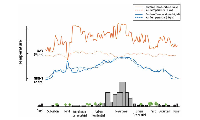
Heat islands are usually measured by the temperature difference between cities relative to the surrounding areas. Temperature can also vary inside a city. Some areas are hotter than others due to the uneven distribution of heat-absorbing buildings and pavements, while other spaces remain cooler because of trees and greenery.
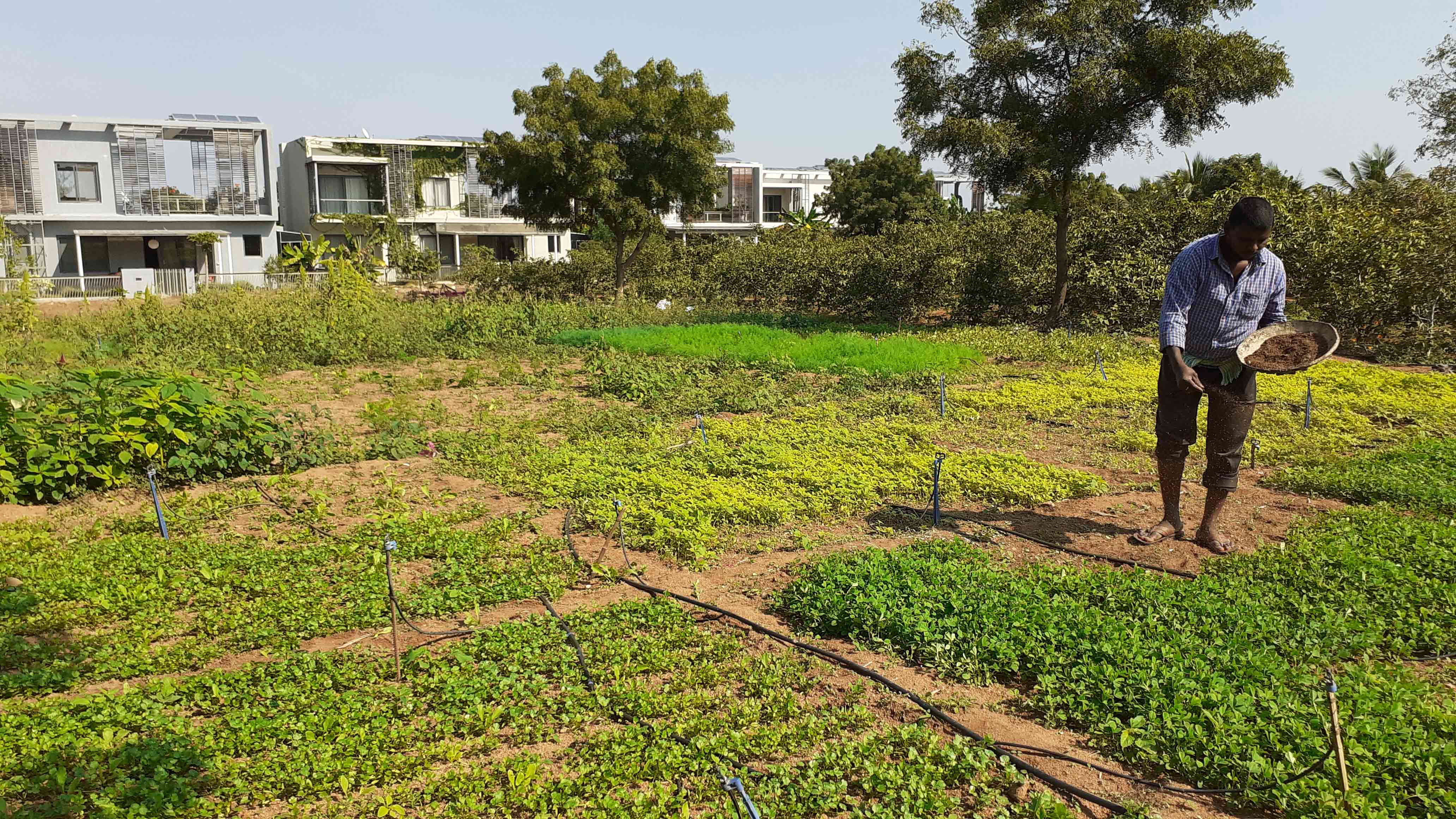
One of the primary reasons is increased building density, both vertically (high-rise buildings) and horizontally (villas), which is governed by the high land cost (real estate) that can be recovered by minimizing green spaces and maximizing built-up area.
Below is a screenshot taken of Gachibowli, Hitec City, Madhapur, Kondapur, Jubilee Hills, Banjara Hills from Google Earth.
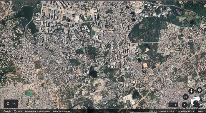
A closer look at this image suggests that the areas appearing in grey and white are buildings (both residential and commercial) and roads (both concrete and bitumen). The different shades of green areas indicate parks and water bodies.
Here’s a bird’s eye level screenshot of the entire of Hyderabad taken on Google Earth.
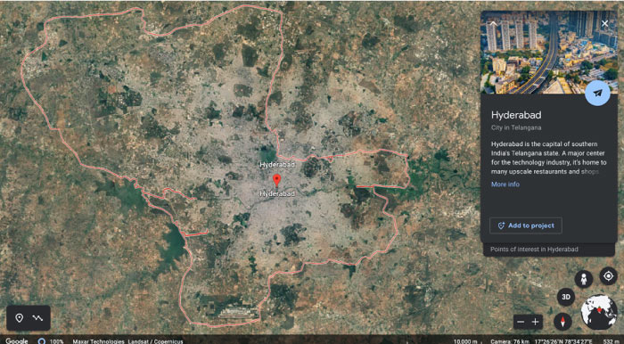
At the outset, the above pictures shows that Hyderabad has very sparse green spaces due to rapid urbanization.
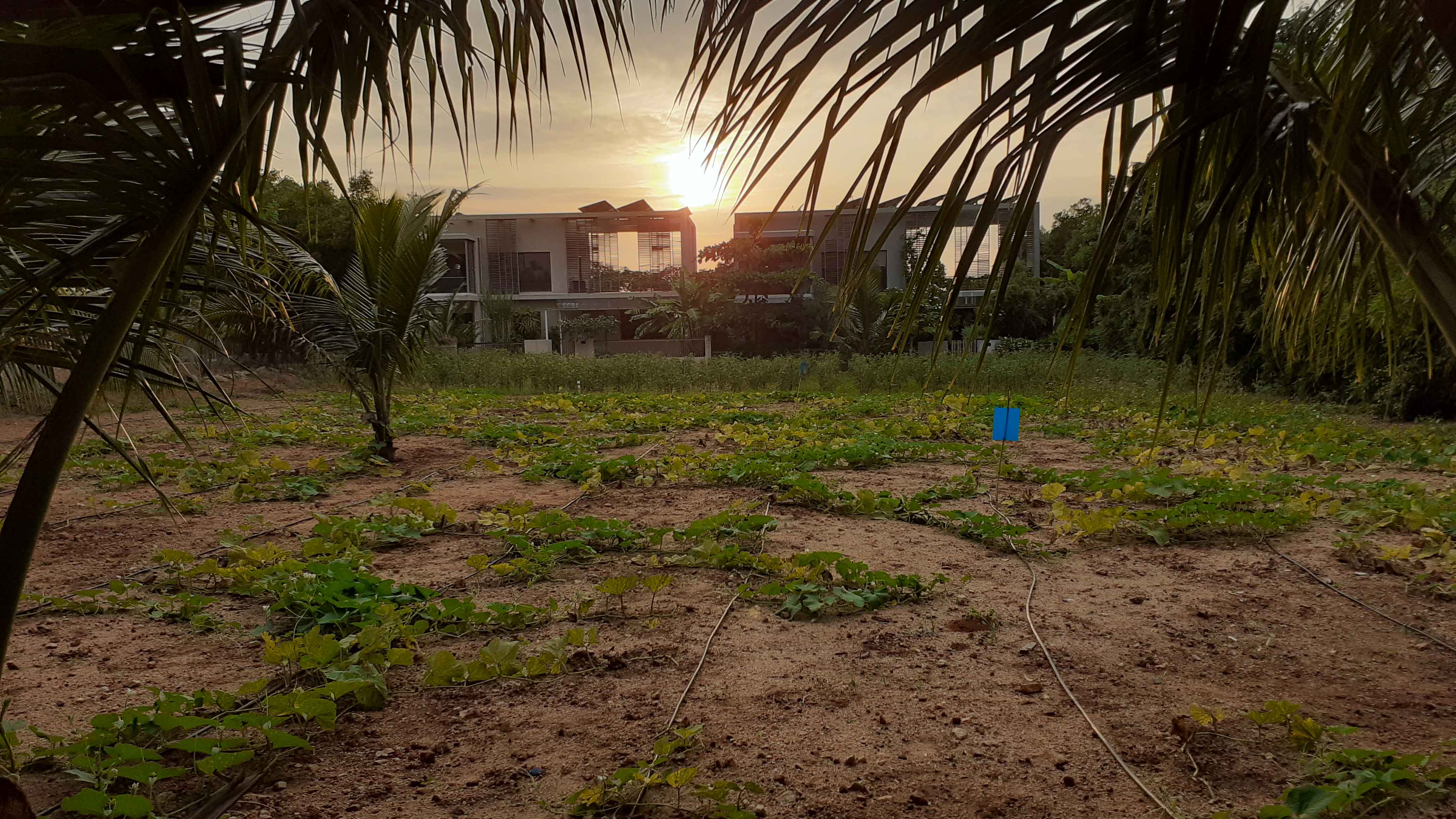
By design, the Rurban Eco-habitats are located far away from urban areas where the land cost is not speculated largely by the real estate market. This helps in allocating and designing landscaping, farmscaping and afforestation which directly help in minimizing local heat island effect.
Another major advantage from this approach is the cool environment in rural area neighbouring our Rurban eco-habitats. Trees, vegetation, and water bodies tend to cool the air by providing shade, transpiring water from plant leaves, and evaporating surface water, respectively.
Birds eye view of Antharam and neighbouring villages on Google Earth.
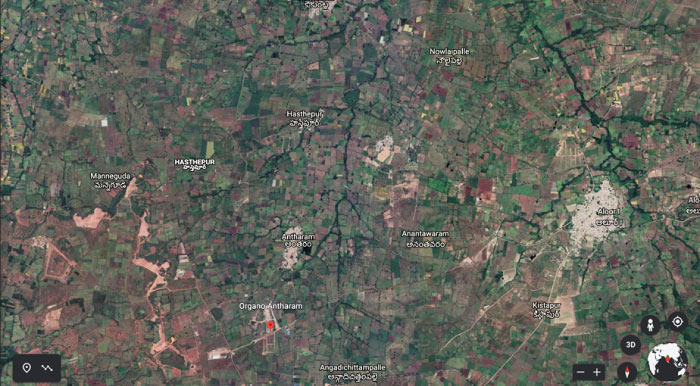
This is one of the reasons why we build our communities far away from urban heat islands.
The local governments around the world have recognized the importance of mitigating and minimising Heat Island Effect through policy advocacy.
While the localised Heat Islands can be mitigated by strategically designing trees, vegetation, water bodies and farming spaces closer to livable spaces, where possible.
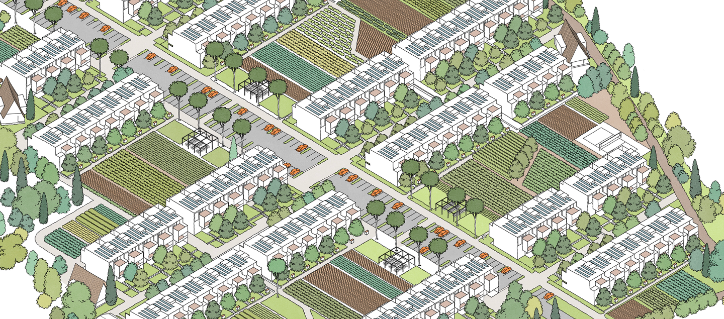
One such example of this design strategy is the ‘God’s Own Office’ in Organo Antharam where the water bodies near the entrance cools the air and works as an intermediary storage structure for farmscaping in the southern side of the community.
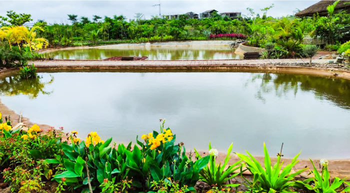
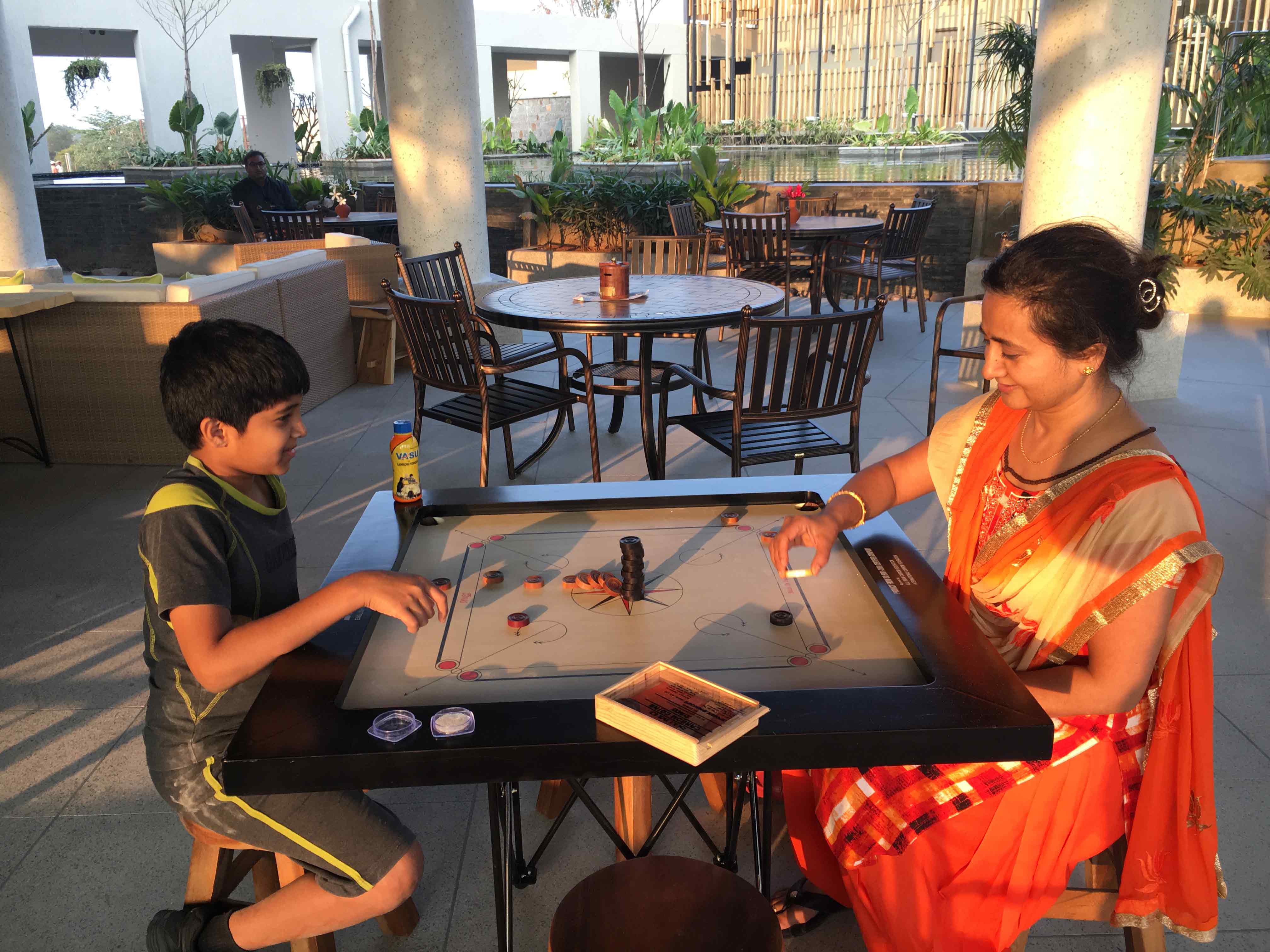
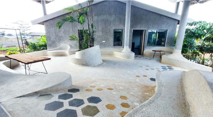
God’s Own Office has outdoor spaces designed for the residents to work, lounge, and relax, where thermal comfort is of primary importance.
On the other three sides, it is covered completely with a combination of farm and afforestation areas, thus cooling the ambient air temperature. One can observe a steep temperature difference during hotter months.
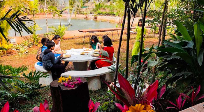
How would you like to spend time outdoors in a Rurban Eco-habitat like Organo Antharam?